35 LEONARD DR
Owner Information
GRIFFIN RITA F
35 LEONARD DR
MARLBOROUGH, MA 01752


Property Details
35 LEONARD DR is classified as a Single Family Residential (Colonial).
The primary structure on this property was built in 1976. There are 3,952ft2 of built area within this property. There is 2,224ft2 of residential/living space within this property. This property is listed as having 8 rooms.
35 LEONARD DR is valued at $407,100. The land is valued at $145,000 and the structures are valued at $257,600. There is an additional valuation of $4,500 on this property.
This property is in Zone A2. Confirm with local Zoning Board authorities to ensure there are no overlays or other easements on this property.
The most recent deed for 35 LEONARD DR is recorded at the local registrar in Book 12728, Page 446.
Assessment data from fiscal year 2021.
Flood Data
According to the FEMA National Flood Hazard Layer, this property does not appear to be in a flood zone. It may also be in an area not yet reviewed. Nonetheless, confirm this information prior to taking any action.
To view the flood hazards around this property, create a FEMA "Firmette" Map of the area around 35 LEONARD DR.
Broadband Internet Providers
| Provider | Type | Bandwidth (mbps) | |
|---|---|---|---|
| Verizon New England Inc. | Fiber | 940 | 880 |
| Comcast | Cable | 1000 | 35 |
| T-Mobile | Fixed Wireless | 25 | 3 |
| GCI Communication Corp. | Satellite | 0 | 0 |
| HughesNet | Satellite | 25 | 3 |
| VSAT Systems, LLC. | Satellite | 2 | 1 |
| MCI | Copper Wire | 0 | 0 |
| Crown Castle Fiber | Fiber | 0 | 0 |
| Viasat Inc | Satellite | 100 | 3 |
| Verizon New England Inc. | DSL | 3 | 0 |
Broadband service provider data from December 2020.
Adjacent Properties
- 26 MACQUARRIE DR
Single Family Residential owned by SOWA JONATHAN M - 34 MACQUARRIE DR
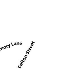
Single Family Residential owned by ETHIER EDWARD R - 40 MEMORY LN
Single Family Residential owned by BLAIR MICHAEL R - 33 MEMORY LN
Single Family Residential owned by BAKER MARI-JANE - 29 LEONARD DR
Single Family Residential owned by ALBUQUERQUE MARCOS A - 40 LEONARD DR
Single Family Residential owned by PARKER WAYNE C